

KCSE Past Papers Geography 2015
SECTION A
Answer all the questions in this section.
1. The diagram below represents the structure of the earth. Use it to answer question (a).
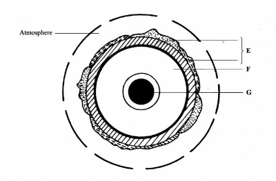
(a) Name:
(i) the layers marked E and F. (2 marks)
(ii) the minerals that make up the layer marked G. (2 marks)
(b) Give two effects of the rotation of the earth on its axis. (2 marks)
2. (a) What is a metamorphic rock? (2 marks)
(b) Give three examples of metamorphic rocks. (3 marks)
3. (a) Name two types of boundaries according to the plate tectonic theory.(2 marks)
(b) Give three effects of the movement of tectonic plates. (3 marks)
4. (a) What is an earthquake? (2 marks)
(b) Identify the scale used to measure:
(i) the intensity of earthquakes; (1 mark)
(ii) the magnitude of earthquakes. (l mark)
5. (a) Give three characteristics of a river in its middle stage. (3 marks)
The diagram below shows a Bird’s foot delta. Use it to answer question (b).
(b) Identify the features marked H and J. (2 marks)
SECTION B
Answer question 6 and any other two questions from this section.
6. Study the map of Busia 1:50,000 (sheet 101/1) provided and answer the following questions.
(a) (i) Convert the ratio scale of the map extract into a statement scale. (2 marks)
(ii) What is the general direction of flow of river Sio? (1 mark)
(iii) Identify the two dominant types of natural vegetation shown in the area covered by the map.(2 marks)
(b) Draw a square 10 cm by 10 cm to represent the area to the west of Easting 30 and north of Northing 40. On the square, mark and label:
(i) an international boundary;
(ii) an air photo principal point;
(iii) river Sio;
(iv) the area above 1200 metres above sea level. (5 marks)
(c) Describe the relief of the area covered by the map (5 marks)
(d) (i) Explain how the following factors have influenced the distribution of settlements in the area covered by the map:
- drainage; (2 marks)
- transport. (2 marks)(ii) Citing evidence from the map, state three functions of Funyula town. (6 marks)
7. (a)(i) Define the term weather. (2 marks)
(ii) Explain how the following factors influence weather:
- cloud cover; (4 marks)
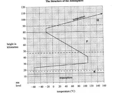
- local winds. (4 marks)The diagram below represents a weather measuring instrument. Use it to answer question (b).
(b) (i) Which element of weather is measured using the instrument shown above? (1 mark)
(ii) Describe how the above instrument is used. (3 marks)
8 (b) Explain how the following factors influence the amount of underground water in limestone areas:
(i) rainfall; (4 marks)
(ii) vegetation cover, (4 marks)
(c) (i) Apart from stalagrnites, name three other underground features formed in limestone areas. (3 marks)
(ii) With the aid of a diagram, describe how a stalagmite is fomred. (8 marks)
(d) Give three reasons why there are few settlements in Karst landscapes. (3 marks)